Directions
- Read more about the directions to Koli National Park and the shuttle taxi details.
- Do not hesitate to contact our customer service at the Koli Nature Centre Ukko – we will be happy to help you plan your excursion.

By car
The recommended starting and finishing points for the trail are the Visitor Centre Ukko (Ylä-Kolintie 39), Kiviniemi (Mustalahdentie 27) and the Eteläpää parking area (Eteläpääntie 113, Kontiolahti).
Maps

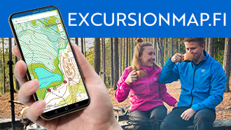
- Excursionmap.fi of Metsähallitus
- Koli National Park brochure (pdf, 1884 kb, julkaisut.metsa.fi)
- National Land Survey of Finland map service (karttapaikka.fi)
- Koli Skiing Routes Map (mapline.fi)
Other Maps
- Pohjois-Karjala (North Karelia Region), waterproof outdoor map, 1:25 000, Calazo 2021.
- Koli Ruunaa Patvinsuo Petkeljärvi, water resistant outdoor map 1:25 000. Karttakeskus 2020.
- Kolin retkeily- ja palvelukartta: Outdoor and service map of Koli, 1:50 000 and 1:25 000, 2011.
- Koli: geologinen retkeilykartta ja opaskirja: Koli geological hiking map and guidebook (in Finnish), 1:20 000, Geologian tutkimuskeskus 2003.
- Maastokartat: Terrain maps P534 and P532, 1:50 000, Maanmittauslaitos.
- Maastokartat: Terrain maps 4313 08, 4313 09, 4313 10, 4313 11 and 4313 12, 1:20 000, Maanmittauslaitos.
- Retkeily GT Itä-Suomi: Outdoor GT Map Eastern Finland, 1:250 000, 2022.