Directions
By Public Transportation
- To Pallastunturi
- There is a daily coach (matkahuolto.fi) from Hetta, Muonio and Kolari.
- Secure your seat by purchasing a ticket in advance.
- Hetta can be found on the website under the name Enontekiö.
- There is a daily coach (matkahuolto.fi) to Jerisjärvi, which follows the route Rovaniemi - Kittilä - Jerisjärvi - Muonio. From Jerisjärvi visitors must order a taxi to Pallas.
- There is a daily coach (matkahuolto.fi) from Hetta, Muonio and Kolari.
- To Hetta
- There are coaches (matkahuolto.fi) daily from Rovaniemi to the municipal centre of Enontekiö, the village of Hetta.
- There is a daily coach (matkahuolto.fi) from Kolari and Pallastunturi to Hetta.
- Secure your seat by purchasing a ticket in advance.
- Hetta can be found on the website under the name Enontekiö.
- More information about connections (enontekiolapland.com)

By Taxi-service
- During peak seasons shuttle taxis travel from Kittilä airport (finavia.fi) and Enontekiö airport to the major tourist centres in the area.
By Car
- You can get closest to the trail in the south at Pallastunturi, in the north at Hetta Village and close to the trail's halfway point at Ketomella and Vuontispirtti.
- For detailed directions on how to get to Pallastunturi see the Pallastunturi page and for details to Vuontispirtti see the Pallas-Yllästunturi National Park Directions and Maps page.
- Ketomella is located by road 957 (Raattama - Peltovuoma) about 20 km north of Raattama.
- Private enterprisers can transport your car from one starting point to another between Hetta and Pallas.
- Cape Lapland (hettahuskies.com)
- car transportation
- Koru Laakso (korulaakso.com)
- car and boat transportation
- Lomakylä Hetan Kota (hetankota.fi)
- car and boat transportation
- Lomakylä Paavontalo (facebook.com)
- car transportation
- Näkkälä Eräpalvelut (nakkala.com)
- car transportation
- Vihreä keino (vihreäkeino.fi)
- boat transportation with a rowing boat
- Cape Lapland (hettahuskies.com)
Maps


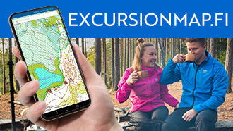
Electronic Maps
Other Maps
- Hetta Pallas Ylläs, waterproof outdoor map, 1:50 000. Calazo 2022.
- Pallas Hetta Olos Waterproof Outdoor map, 1:50 000, Karttakeskus 2019.
- Terrain maps V413, V 414, 1:50 000.
- Retkeily GT Pohjois-Suomi: Outdoor GT Northern Finland, 2016, 1:400 000.